Skip to content
Radar Systems

MERLIN™ Wind Energy Bird Monitoring Systems (BMS) Bird Monitoring and Mitigation Systems

DeTect specializes in the delivery, integration, and support of more than 500 systems worldwide. These advanced and proven bird-monitoring systems are offered for use by wind-energy project developers, owners, operators, and environmental consultants in bird and bat studies, mortality-risk assessment, operational monitoring, and real-time risk mitigation.

DeTect provides the following advanced bird-monitoring systems and related services for wind-energy projects:

  • Preliminary site assessment using NEXRAD radar data

  • Onshore and offshore bird and bat radar systems

  • Bat detection and tracking radars

  • Processing, analysis, and reporting of bird-monitoring data

  • Bird and bat mortality-risk assessment

  • Radar-based mortality-risk mitigation systems

Bird and Bat Radar Technologies

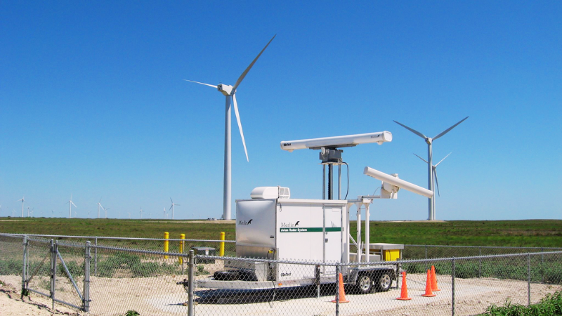
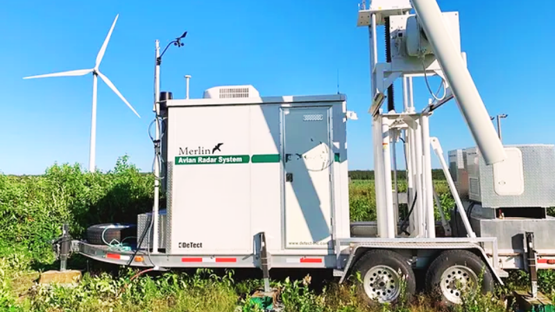
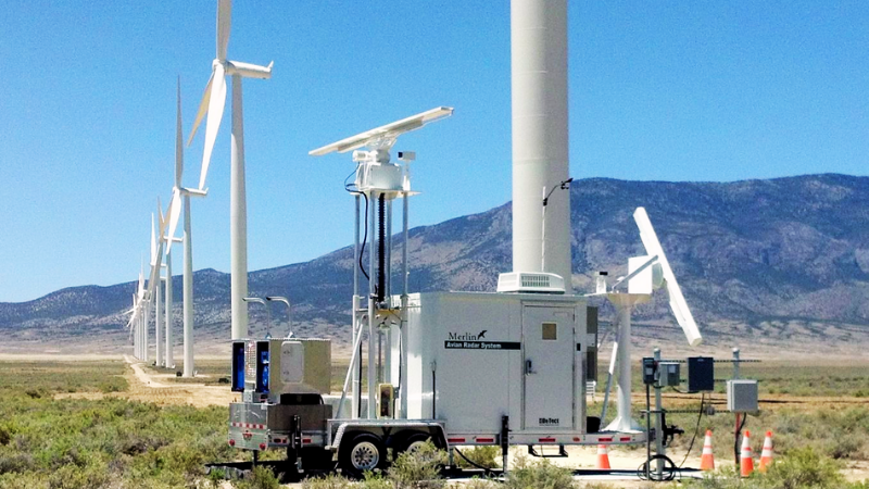
DeTect is the developer and manufacturer of the MERLIN Avian Radar System. More than 500 MERLIN systems have been delivered worldwide, and the system is used as an advanced and proven bird and bat monitoring technology. It is used in wind-energy projects for bird studies, risk assessment, monitoring, and real-time risk mitigation. MERLIN technology was originally designed as a precision bird-detection radar system developed for the U.S. Air Force and NASA and has been used to help controllers, pilots, and managers reduce bird-aircraft strike risk by providing real-time information.

MERLIN™ technology is capable of collecting high-quality data on bird activity within a range of 3–8 miles at proposed wind-energy facility sites. These data can be used to develop detailed pre-construction mortality-risk projections and for operational mitigation purposes.

MERLIN SCADA can be used at operational wind-energy facilities with its bird and bat mortality-risk mitigation capability and can function as an “early warning” system that enables the early detection of bird and bat activity associated with mortality risk. The system automatically activates response and mitigation measures, including keeping turbines stationary until the mortality risk has passed.

DeTect provides full operational and technical support to wind-energy facility owners, developers, operators, and consultants in areas such as system deployment, operation, user training, data processing, analysis, reporting, and QA/QC.

The expert staff consists of bird-radar ornithologists, bird biologists, engineers, and statisticians. They have specialized knowledge and expertise in the design, construction, and operation of bird and wildlife detection systems, particularly for real-time aviation safety and environmental management.

MERLIN™ Advanced Bird Monitoring System

MERLIN provides a cost-effective, scientifically sound, and comprehensive method for collecting high-quality and statistically robust data on bird and bat movements at proposed onshore and offshore wind-turbine installations.

Originally developed for demanding aviation-safety applications, MERLIN is an advanced and proven technology used for bird and bat studies, with more than 40 systems operating at wind-energy facilities in the United States, Canada, the United Kingdom, Europe, Africa, and New Zealand.

The systems incorporate solid-state Doppler radar technology with customized bird-mode waveforms specifically developed for bird and bat detection and tracking. In addition, optional frequency-diversity processing provides enhanced detection capability in heavy ground and sea clutter.

Using state-of-the-art radar and computer techniques specifically developed to detect and track the unique behavioral characteristics of birds and bats, MERLIN continuously and automatically collects data under various conditions. This process produces highly accurate and detailed datasets for analysis. The resulting data can be used in project decision-making and permitting processes.

Real-Time and Archived Bird Activity Monitoring

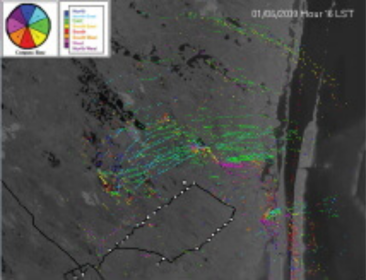
MERLIN processes radar signals in real time and, with high update rates of 1–2 seconds, provides live information to project biologists and wind-energy facility operators on the location, flight paths, altitudes, sizes, and other characteristics of bird activity. Multiple users can view the information display simultaneously and remotely control the system via LAN, satellite, and WWAN (cellular) data connections.

All system operating settings can be accessed through graphical user interfaces (GUIs) on password-protected screens, and real-time changes can be made while the system is operating. All system functions can be controlled remotely, the system can be shut down, and a cold restart can be performed.

MERLIN is fully automated for continuous 24-hour operation and includes an internal Health and Safety Monitoring System (HSM). This system continuously performs diagnostics and provides audible, visual, text-based, and email alerts in the event of system issues such as power loss or component failure.

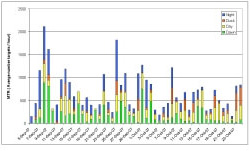
Data are also automatically archived in the internal MERLIN SQL server data system, creating a permanent record for each project and supporting detailed analysis, modeling, and quantitative mortality-risk assessment. MERLIN SQL includes an Internal Data Report that provides a range of standard wind-energy information and analyses, such as passage rates, percentage of the rotor-swept zone, and flight patterns.

MERLIN Reporter, MERLIN TrackPlot, and MERLINChart include three unique routines. These routines automate user analysis by region and time period. The system also supports custom user-developed queries and analyses in GIS and other third-party software. The data system has sufficient storage capacity to retain continuously collected 24-hour data for several years and can be easily expanded by adding commercially available low-cost plug-and-play hard drives.

Advantages of MERLIN™ Technology

The MERLIN system is an advanced technology for wind-energy projects and offers significant advantages over conventional visual bird-inventory and manual radar-ornithology techniques.

Key advantages include:

  • Larger datasets

  • Highly accurate passage rates

  • Storage of all data in the SQL system

  • Detailed altitude and count data within the rotor area

  • Identification of flight patterns across the wind-resource area

  • Quantitative determination of mortality risk

  • Highly defensible and statistically reliable data

  • Support for real-time and automated mortality-risk mitigation

The MERLIN Avian Monitoring System is one of the powerful tools available for evaluating proposed wind-energy projects and produces high-quality, detailed datasets. These datasets can be used to accurately determine the number of birds and bats passing through rotor areas during daytime, nighttime, and low-visibility conditions.

DeTect's proprietary Data Reports software produces detailed datasets in table and graph formats and enables precise calculation of the number of birds and bats passing through the rotor area.

MERLIN™ SCADA Bird and Bat Mortality Risk Mitigation Systems

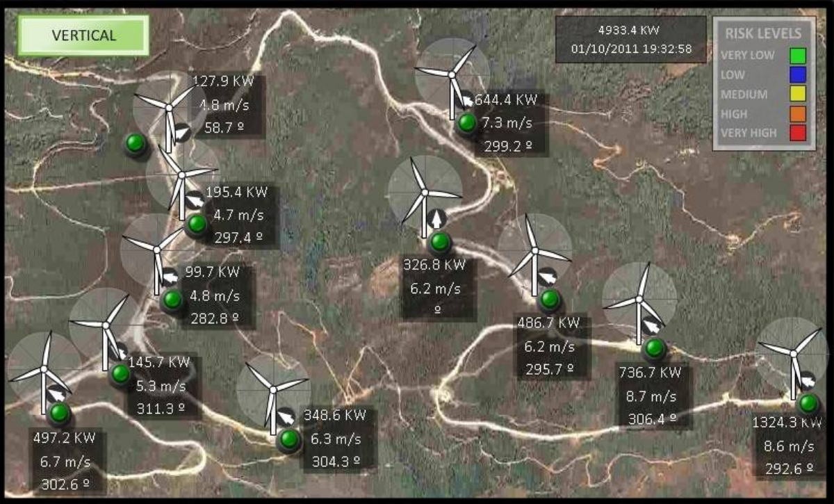
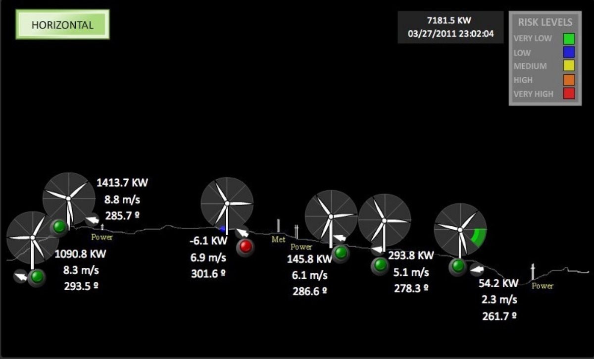
For operating wind farms, DeTect's MERLIN SCADA (Supervisory Control and Data Acquisition) functionality enables the MERLIN system to operate as a real-time bird and bat monitoring and risk-mitigation system. MERLIN SCADA software combines the MERLIN Avian Radar System with other sensor-data inputs, including weather and visibility information, to provide real-time radar-based shutdown or deterrence. This helps prevent bird mortality while supporting maximum energy production.

DeTect's MERLIN SCADA is a proven bird and bat mortality-risk mitigation technology used at wind farms to help protect migratory birds, local birds, raptors, and bats.

MERLIN SCADA provides early warning to wind-farm managers and operators when risk conditions are identified for migratory or individual birds and bats detected within a range of 3–8 miles. When risk conditions are detected by the MERLIN system, it can activate response mechanisms that include manual or automatic turbine shutdown. The system can operate automatically under all weather and visibility conditions; when risk is detected, it can stop turbines individually, in groups, or collectively and restart them when risk conditions return to normal.

MERLIN SCADA operating software is fully compatible with all wind-farm turbines and SCADA systems. DeTect provides comprehensive development, integration, implementation, and operational support, including the development of real-time remote operator-interface displays.

In recognition of DeTect's contribution to environmentally sustainable design engineering, MERLIN SCADA received the Green Dot Award in 2008. MERLIN SCADA has been successfully used at wind farms since 2009 for migratory-bird risk mitigation (SCADA-M) and since 2010 for raptor-risk mitigation (SCADA-R). DeTect's Turbine-Focused model can automatically stop the relevant turbine when a raptor approaches it.

DeTect's bird and bat radar systems are supplied as portable, skid-mounted, self-supporting systems containing all hardware and software required for bird and bat monitoring, noise suppression, and data recording. Fully remote-controlled custom offshore configurations can also be provided with additional sensors such as thermal cameras, bat detectors, insect detectors, and vertical profiling instruments.

Systems are available through short-term rental, long-term rental, lease-to-purchase, or direct purchase from DeTect. Options are available with or without DeTect operators. DeTect provides comprehensive technical support from survey work through data analysis, together with parts and labor warranty coverage.


Case Study

U.S. Fish and Wildlife Service (FWS) Great Lakes Radar Study

The U.S. Fish and Wildlife Service (FWS) has multiple years of MERLIN Avian Radar System data for the Great Lakes Region. Data collected using two MERLIN units purchased in 2010 were used to map the effectiveness of wind-energy areas in support of environmental conservation and wind-energy development activities in the region.

Beginning in 2010, FWS studied bird and bat activity using Avian Radar and acoustic bat monitors, accelerating conservation, restoration, and development efforts. Using MERLIN Avian Radar, FWS was able to obtain comprehensive data on where birds and bats migrated, at what altitudes, and under what conditions.

As part of the program, FWS developed a Decision Support Tool (DST) to provide important information about terrestrial habitats, such as stopover areas, and aerial habitats, such as airspace habitat, and to help identify and prioritize areas where migratory birds and nomadic and non-migratory bats could benefit most from conservation efforts.


Related Products

Have questions?